
May & Jennie / Red Top - Continued
Sampling work began at C- which was approximately in line with the upper A adit located downslope.
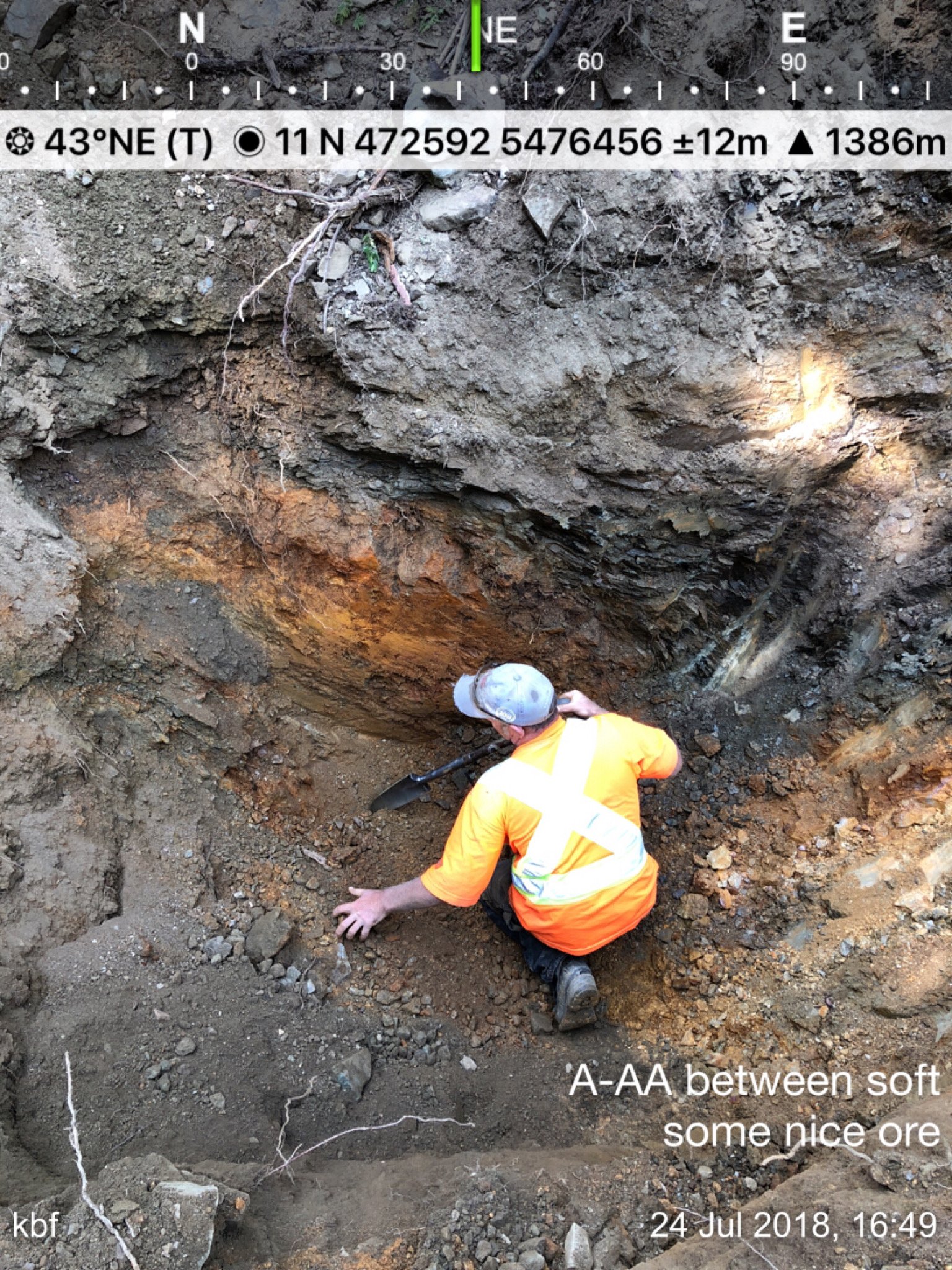
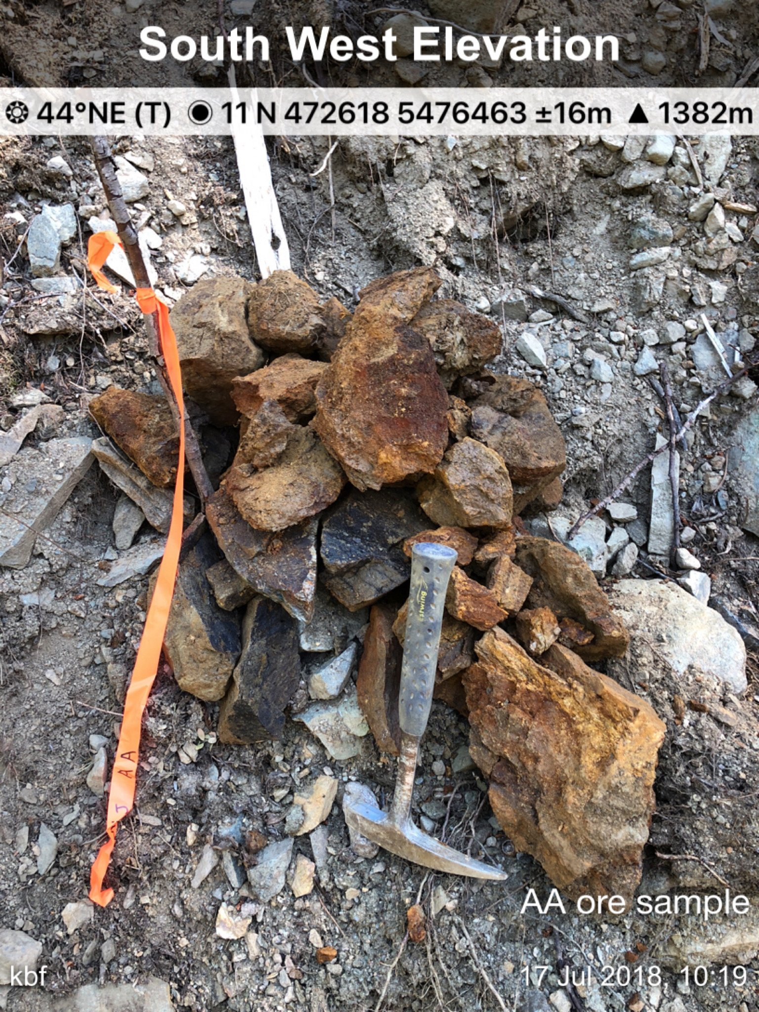
AA was where the A adit road merged into the drill road above.
Z vein was not located (it enters in towards a seasonal creek bed) as may have been washed or ground sluiced out of reach.
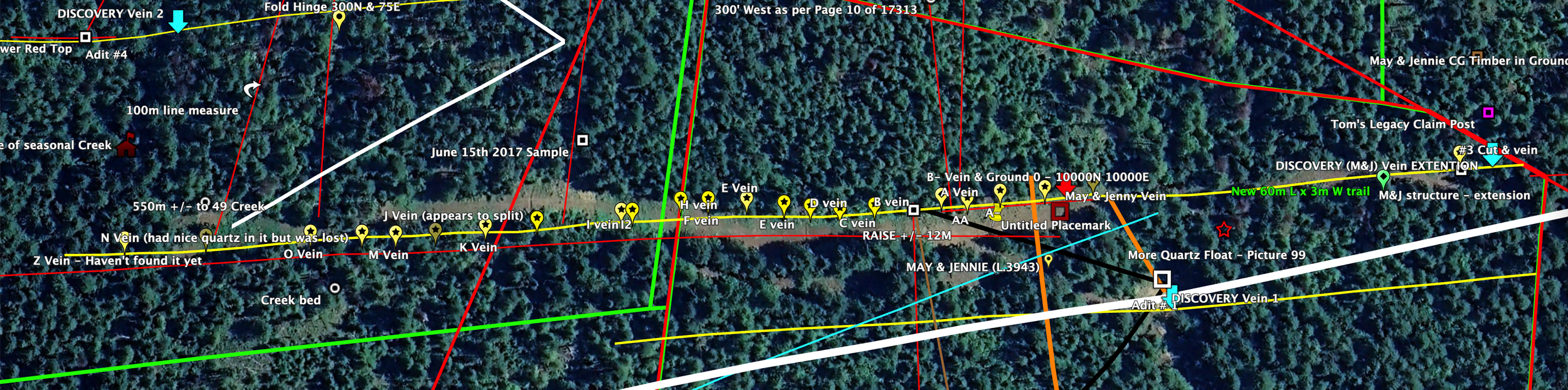
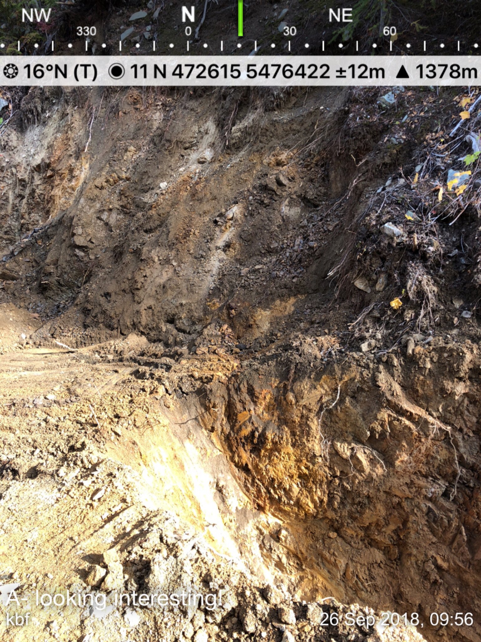
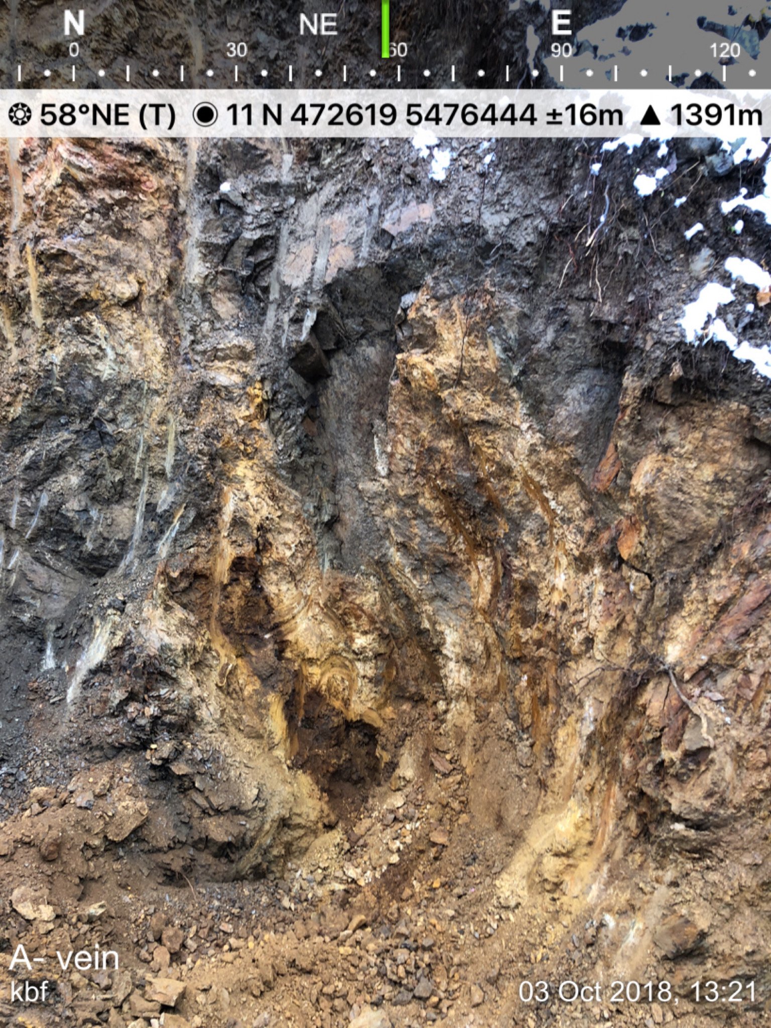
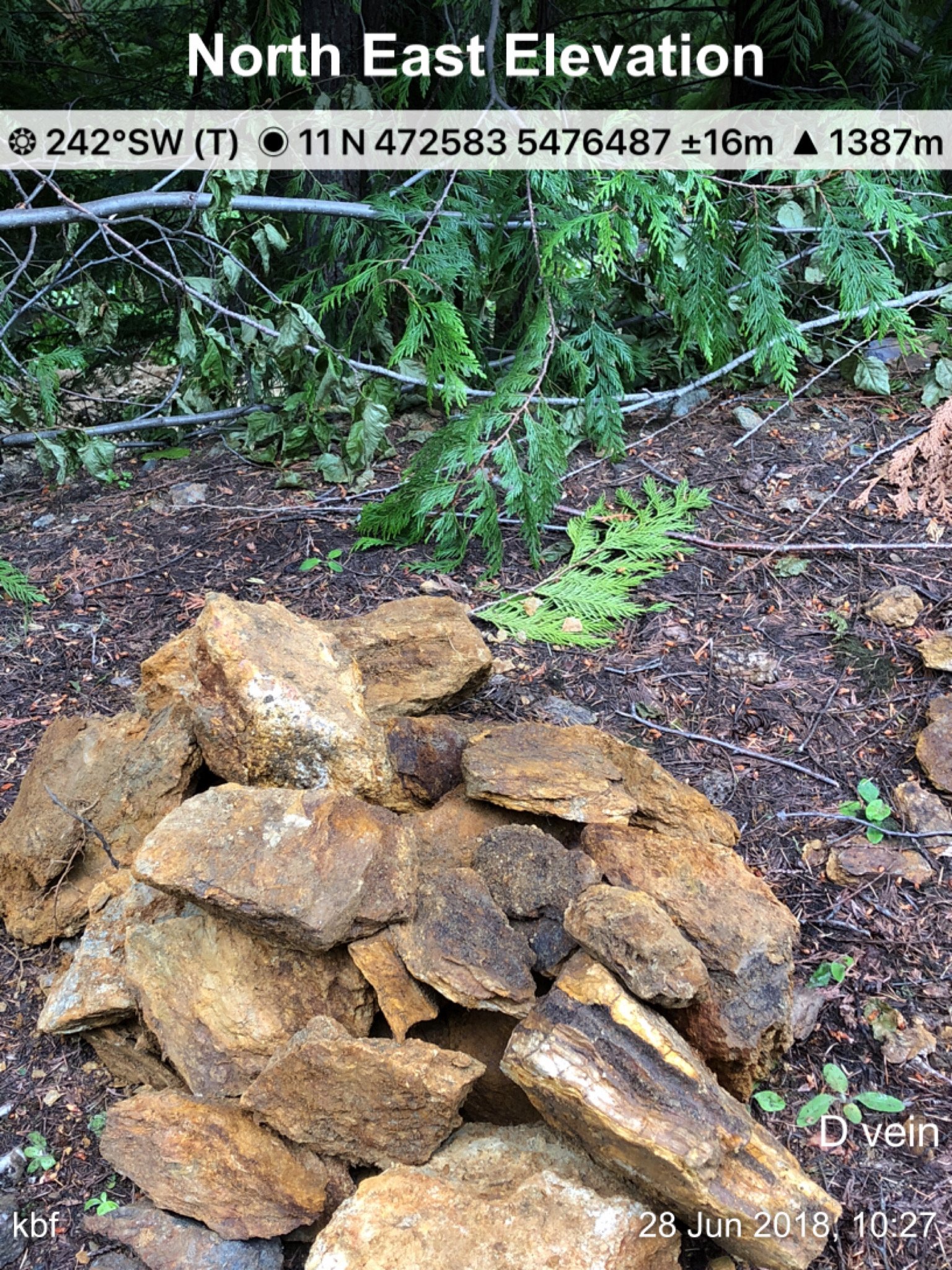
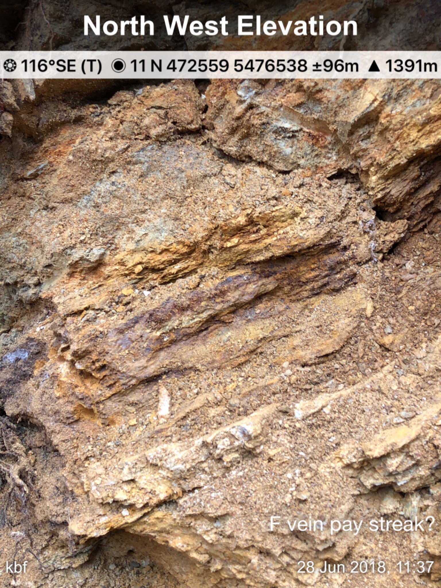
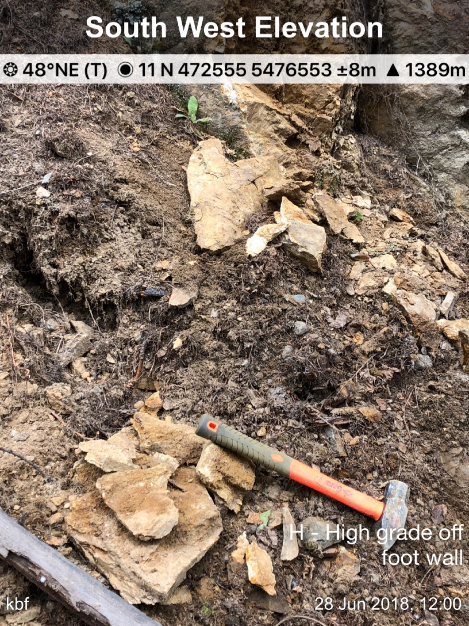
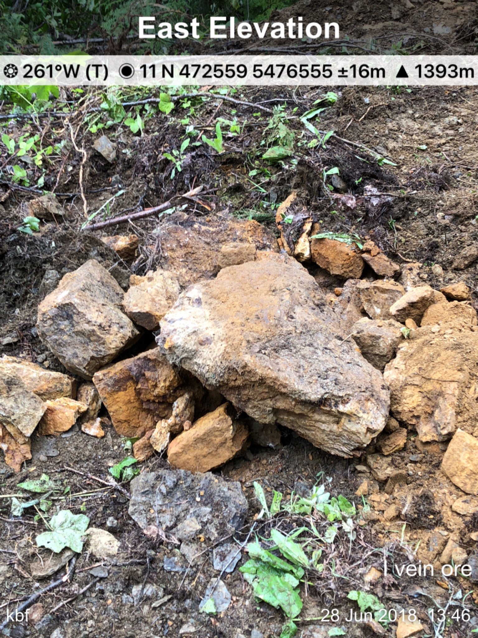
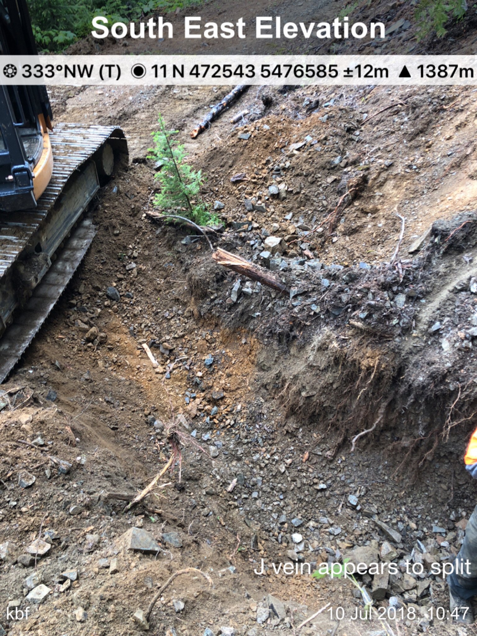
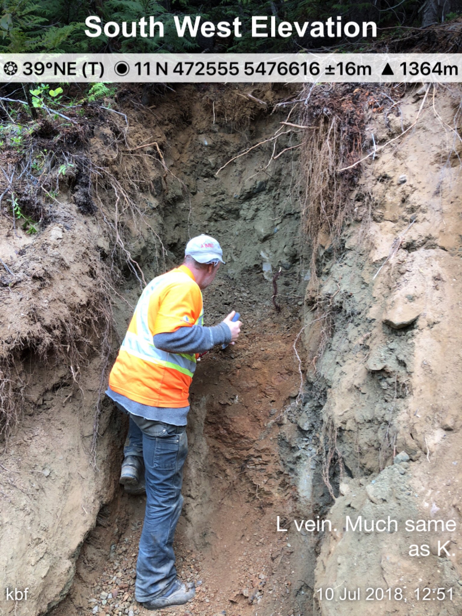
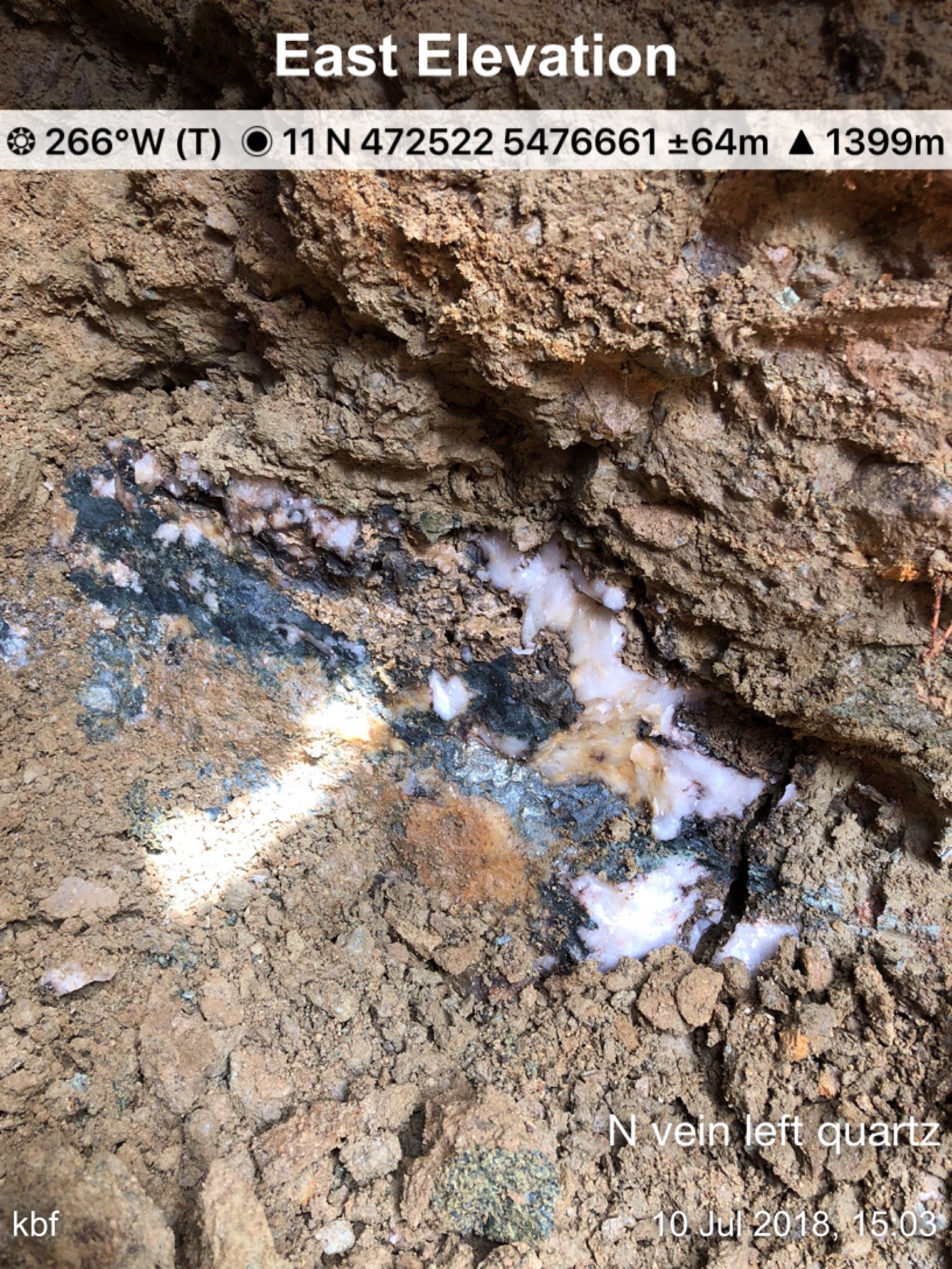
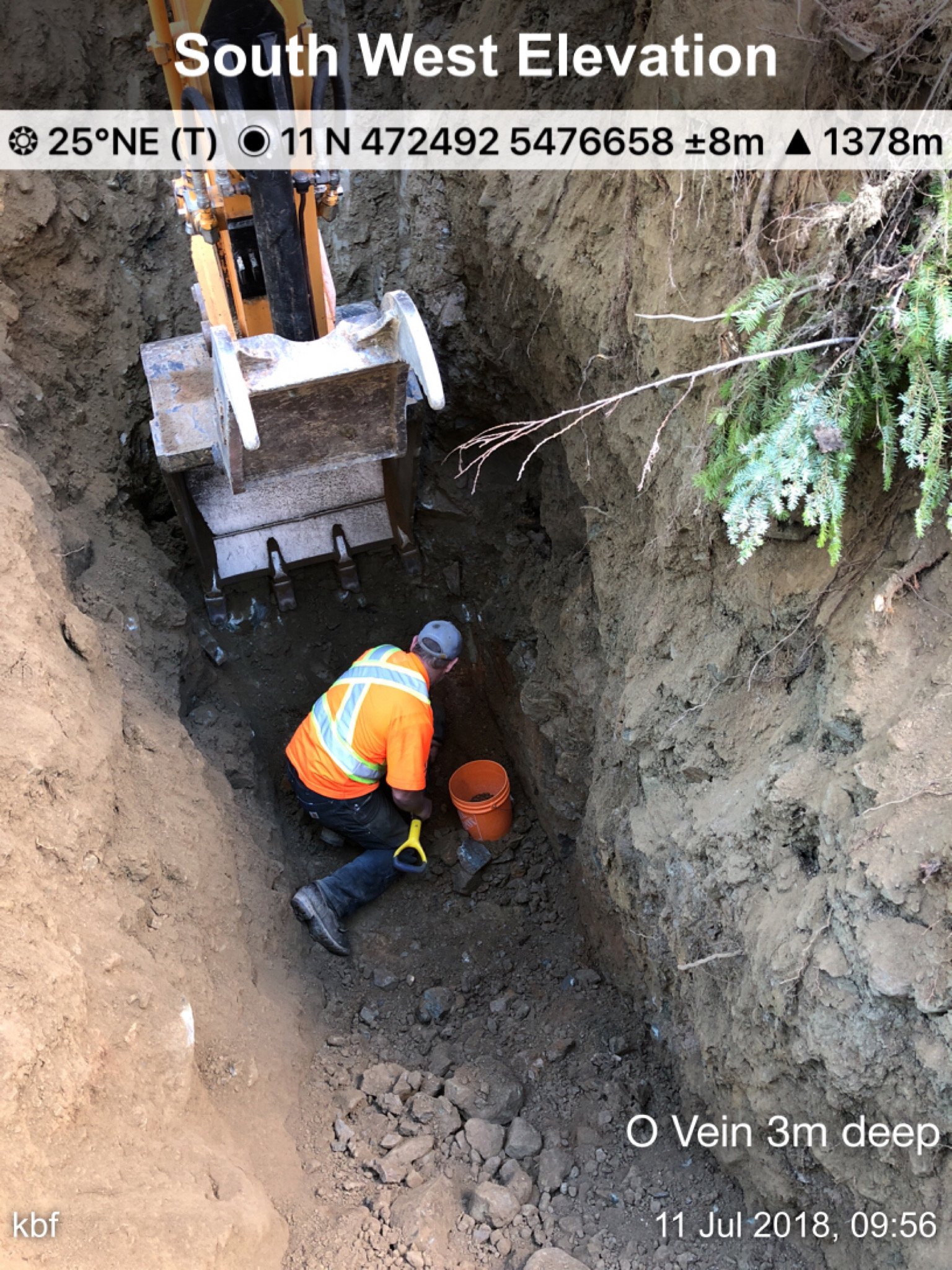
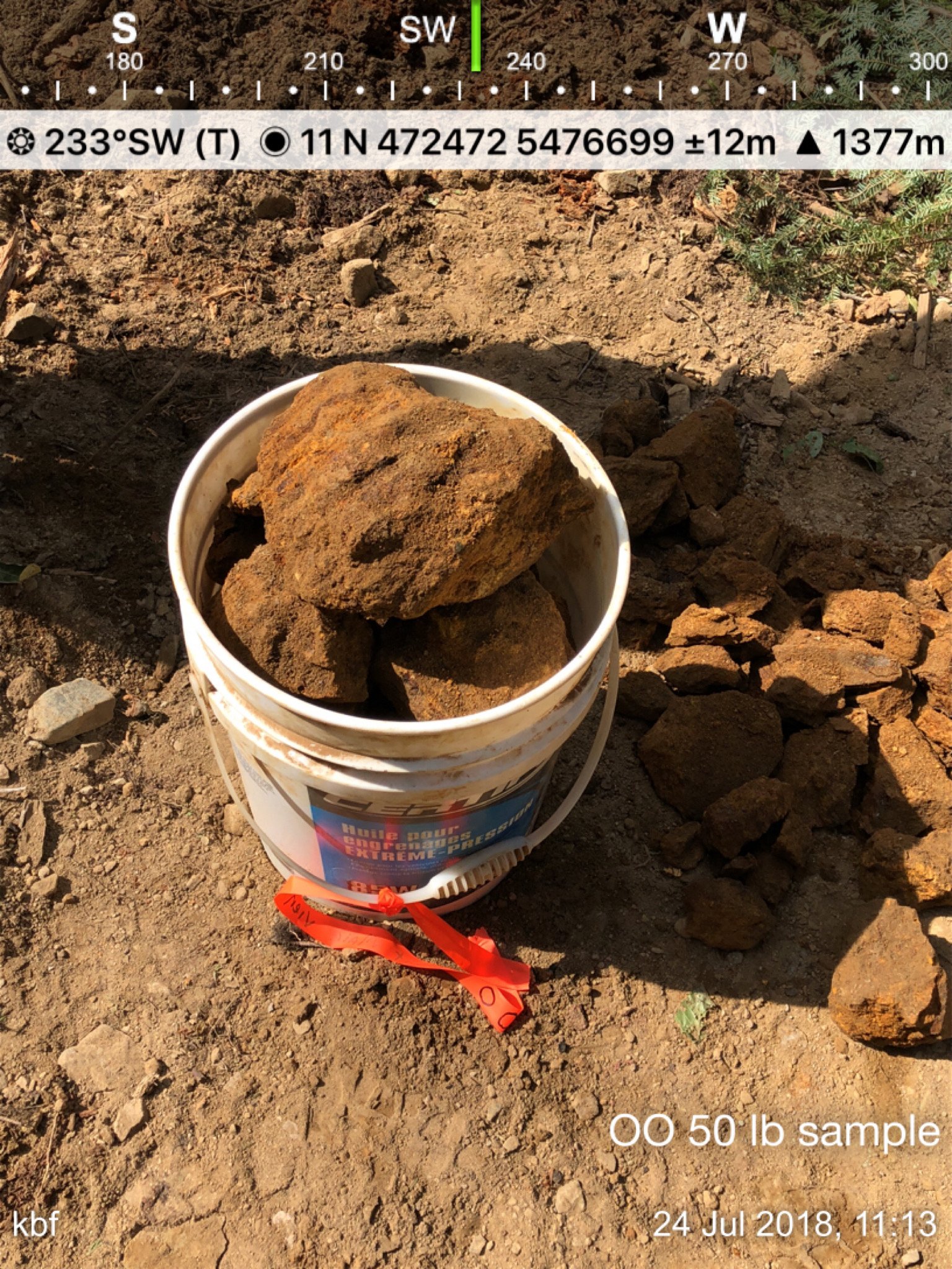
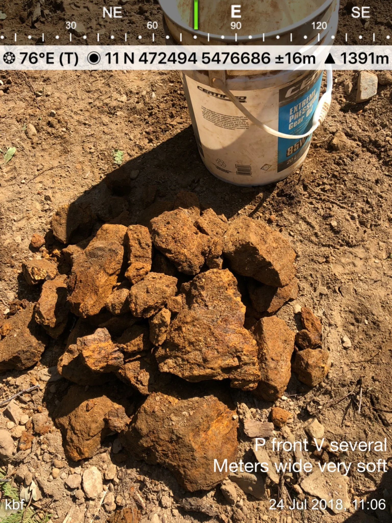
P, OO, O, N, M, L, K, J, I2, I1, (we missed H) G, F, E, D, C, B, A, AA, A-, B-, C-, M&J Extension is seen on the map below.
IMPORTANT
Place the cursor on each Photo Thumbnail for a full-size view or place over images and click Open Image or Open Image in a New Tab to view full-size with all details (including coordinates) of the image.


Linked below are several unedited video clips from a walk-in day trip (Sept. 2020) into the May & Jennie / Red Top Gold Mine site and posted onto YouTube and set up with 2 playlists. The first is a link to a series of clips at the #1 Adit area. The 2nd is a series of videos depicting the May & Jennie vein as we arrive at the drill road and make our way over to the M&J vein extension. From there we make our way most of the way up the drill road and up to the Red Top mineralized area, stopping at most of the marked vein test locations along the way. It was the 1st meaningful visit (other than meeting with my surveyors in 2019) to the property in almost 2 years to see if anything had changed and to pick up a few grab samples.
VIDEO LINK 1 - Inspecting the area around #1 Adit where a massive quartz vein/boulder structure was discovered
VIDEO LINK 2 - Up to the M&J drill road, over to the MJ vein extension, a walk along a majority of the drill road and then over to the Upper Red Top area
More on the Red Top Deposit
The following description of the Red Top showing has been copied and pasted from the Property File Report 17313 proposal letter dated July 2nd, 1934. The heading of the description below was "VEINS" pertaining to the May & Jennie & adjacent reverted crown grants. In this case, the reference was to the showing located on the Red Top reverted crown grant. Gold is referenced at $20.00 an ounce.
VEINS
The easterly of these veins (*referring to the Red Top) is exposed on the ground by a ground sluice from which a cross-cut tunnel has been driven 40 ft. in an easterly direction. This ground sluice is of sufficient importance to warrant description both as regards its appearance and its method of construction. A dam was constructed at a point which forms the head of the sluice and well above the vein which it was expected to disclose. By successfully filling this dam and allowing the water to escape, a channel was cut down the hill at right angles to and across the course of the vein. By these means the wash and surface debris was washed down the hill and a narrow channel cut. At a depth of ten ft. cemented gravel was encountered which was too compact a nature to allow its removal by these means alone. Picking and blasting were resorted to and water was used to remove the debris until a depth of 35 ft. was reached when bedrock was uncovered and the vein found in place. For several hundred feet the walls of this cut, when completed were less than three feet apart and vertical. That such a mass of ground should have stood without timbering shows the extremely compact nature of the wash on the hillside. The vein as disclosed showed nine (9) feet of ore on the westerly or footwall side, then 24 feet of Schist and Dyke, then ore again for fifteen feet in width, from which latter point the crosscut tunnel, before referred to, is driven in an easterly direction for 40 feet more across the vein in mixed ore and Schist. This tunnel is timbered and its face does not expose the country rock of the hanging wall. The vein at this point is therefore more than 88 feet wide. In this tunnel, some coarse gold was encountered. The expansion of this vein is shown by cuts several hundred feet away. An average sample of the 9 ft. a similar sample taken for five feet to the mouth of the tunnel and forty feet into the same, including all material exposed, gave $2.06 gold per ton. As this ore can be mined to a much better grade than is shown by the result given, it is my opinion that a very valuable ore body is developed here which fully warrants extensive exploitation in the future.
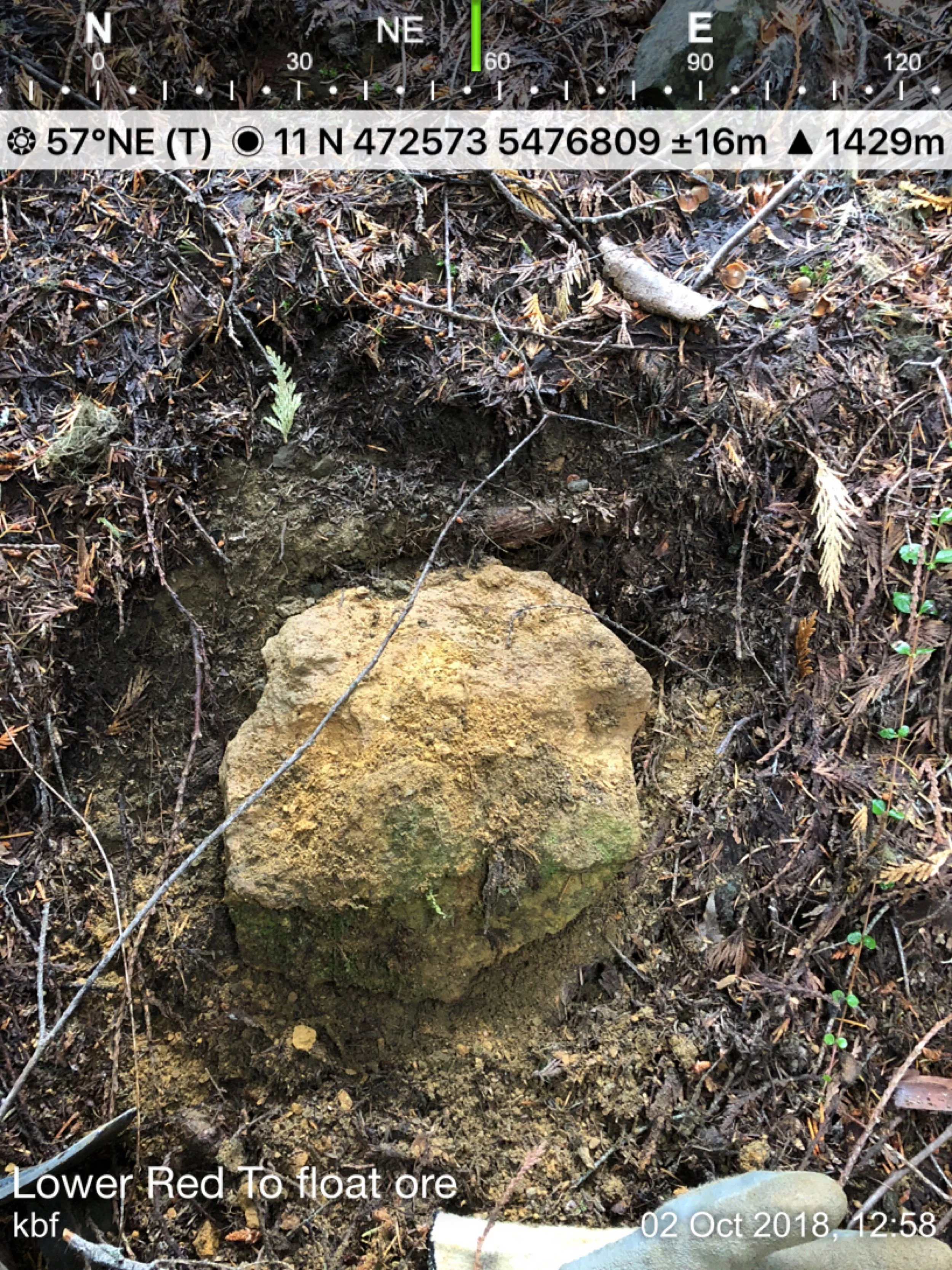
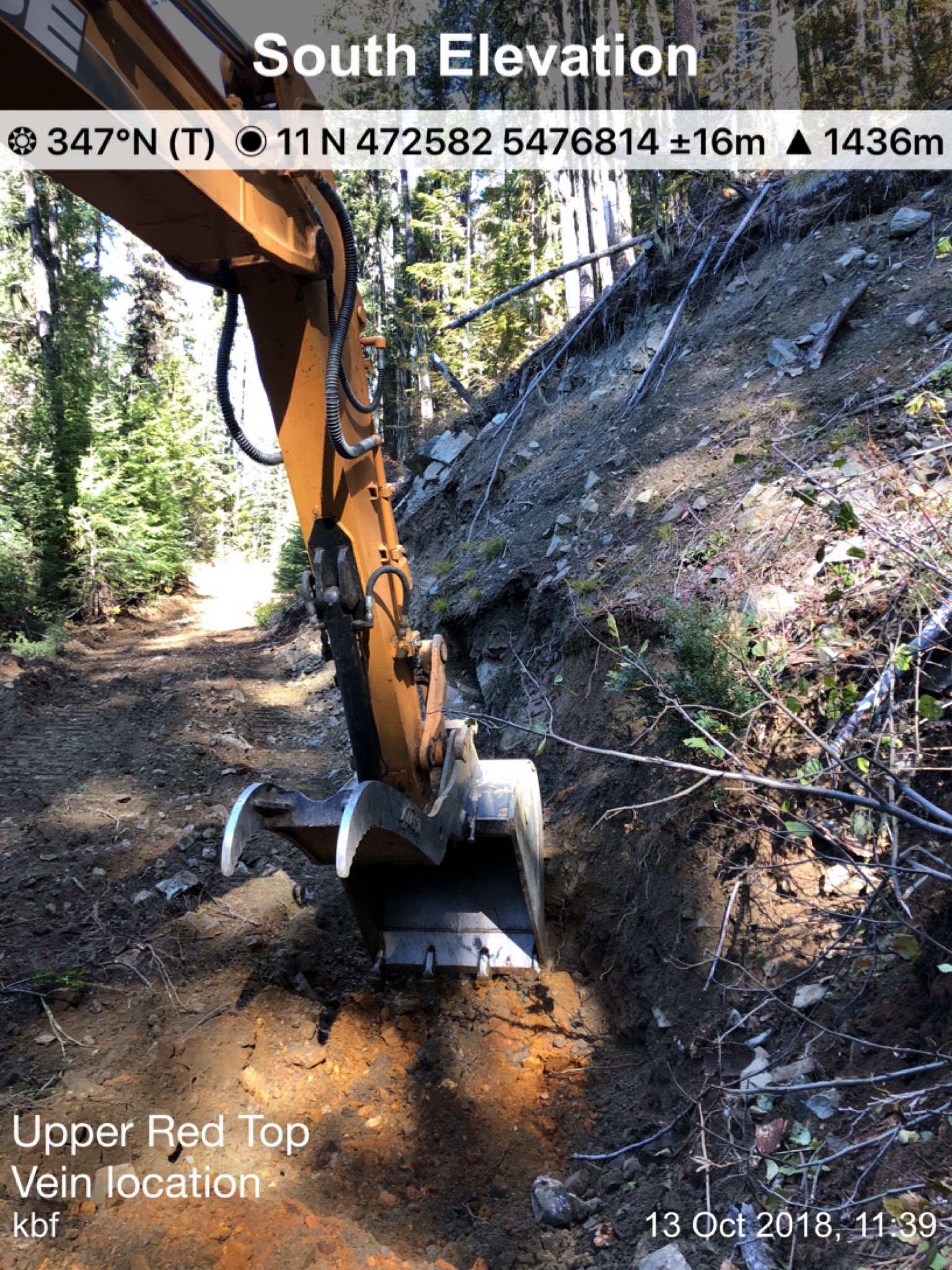
Note – The 1906 Ministry of Mines Report states the upper portion of the vein as being 20 feet. This report states it as being 15 feet so there is a bit of a discrepancy here, although my observation of the UPPER structure was that it appeared to be at least 7m wide (see video below). Still, it was very tough to follow with all kinds of folding going on.
Let's Suppose...
The lower Red Top Adit is located at approximately 10m from 472513E, 5476806N +/- 16m. Let's split the difference between the +/- 16m (8, +10,) and move that location 18m and then add 12m for the length of the Adit which is a very conservatively 30m from where I located the Adit to the supposed face of the ore.
The measured distance from the Lower Red Top to the Upper Red Top is more than 84m. Subtract 30m which then = 54m That makes the structure 54m wide which is twice as wide as stated in the report (above) according to my calculations. Let's take off another 10m for the margin of error. Using the same values except for the width of the structure now being 44m wide, let's assume the deposit is 100m long x with a very conservative depth of 100m x with a density of 2.92 M3, which equates (after converting tonnes to tons) to 182,136 ounces of Au at 4 gpt.
Using a more SPECULATIVE formula of 44m wide x 250m long x 250m deep x a density of 2.92 / m3 = 7,562,500 tonnes = 8,851,560 tons x 1 gpt Au = 8,336,229 grams Au / 31.103 grams per ounce = 284,588 ounces Au. The math at 4 gpt Au brings the potential of this deposit up into the MILLION-ounce category! I would suggest 2 - 3 gpt are very realistic grades from what I have seen to date.
That said, the Red Top portion of the property and its strata-based / folding structure appears to have very REAL (bulk-tonnage) possibilities which will eventually be determined through drilling.


A 2017 (3rd Party) SOIL SAMPLING LOCATIONS & RESULTS) taken off the 49ER & REDTOP CLAIMS before they were converted into a mineral lease


VTEM (Z-OFF) maps above with known Geochemical soil anomalies, VLF and Magnetic Survey Data
Open Image for FULL-SIZE view

Google Earth Map above with known Geochemical soil anomalies (above)
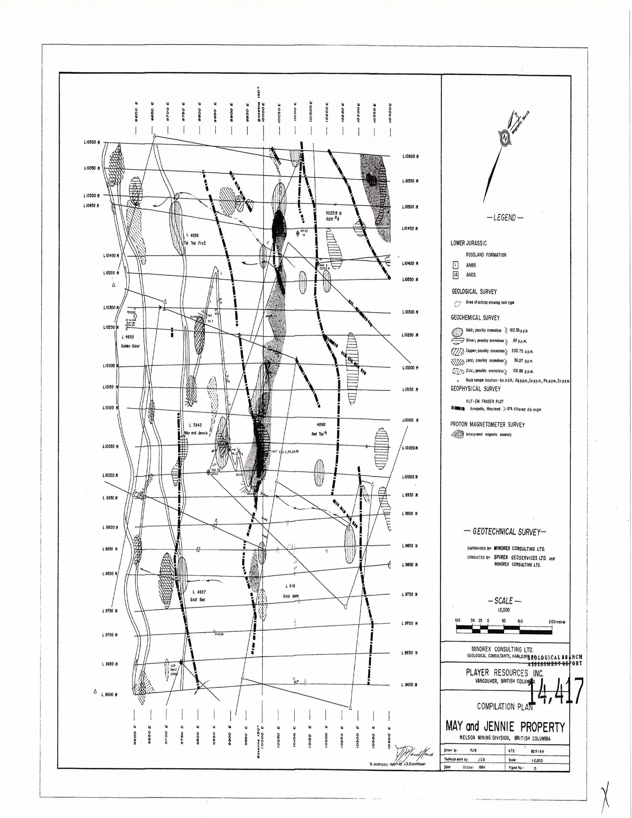
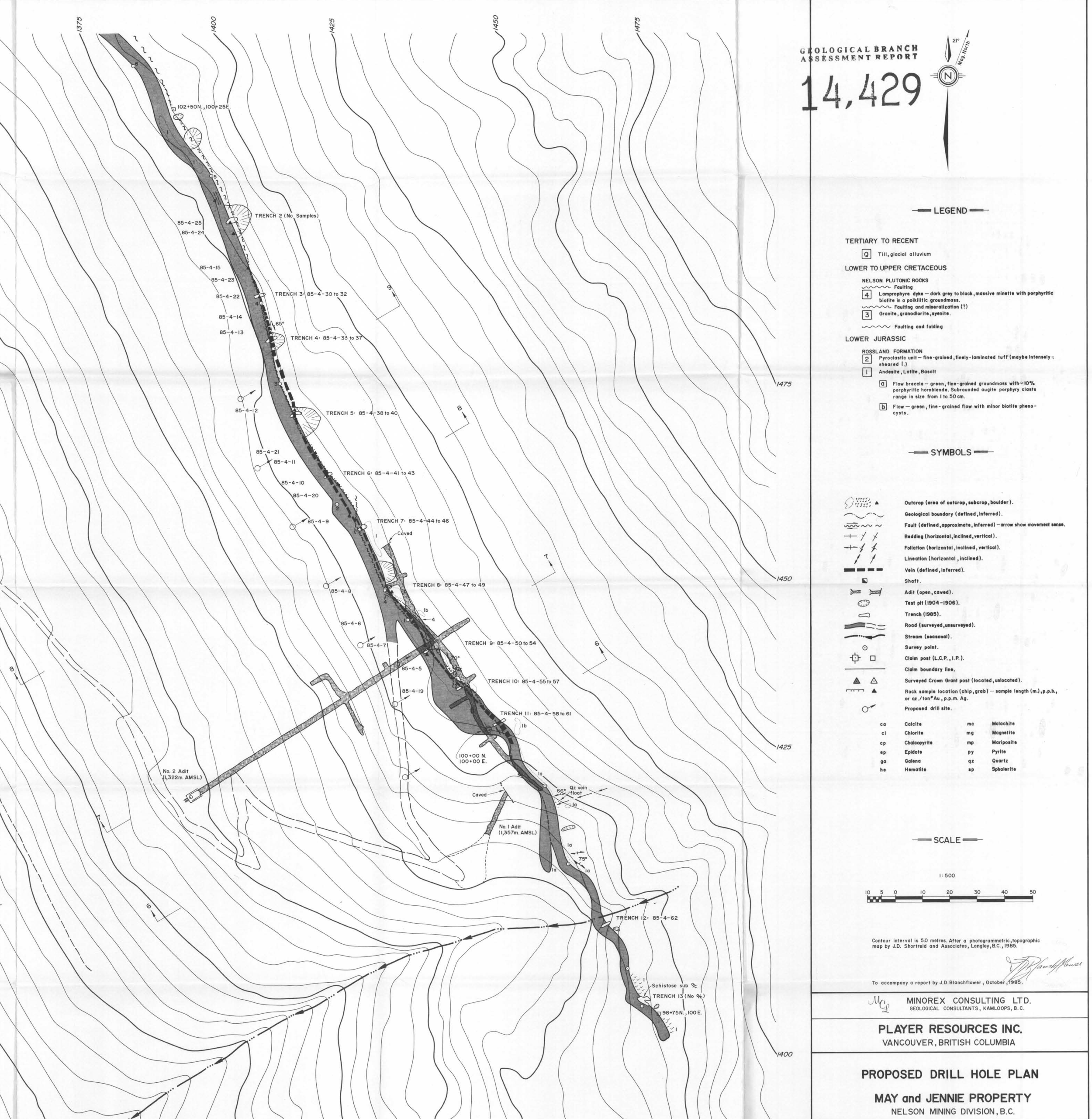
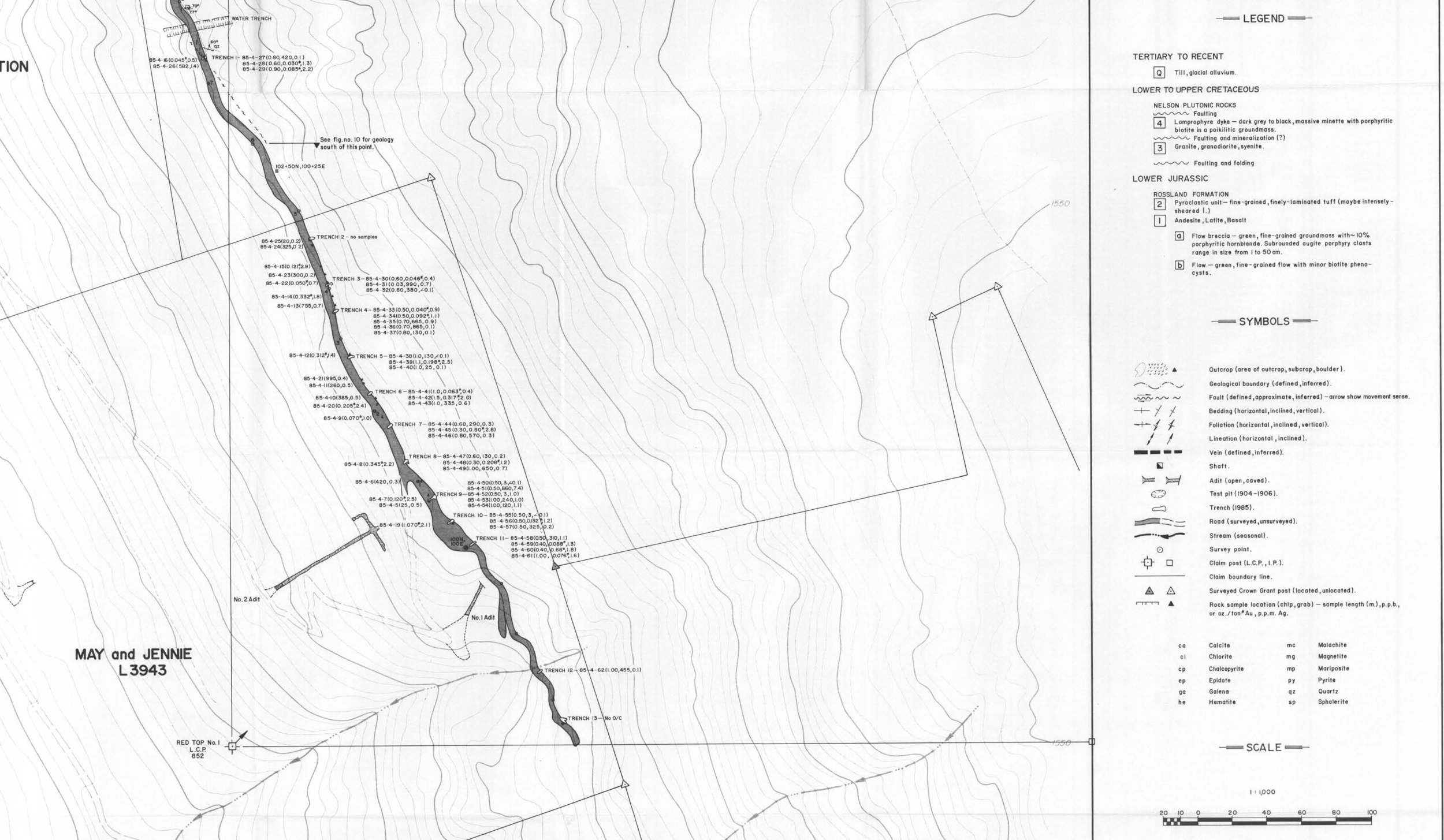
Below is A VLF - Mag Data Map, A Proposed Drill Hole Location Map and sample locations and a Results Map copied from the historical reports ARIS 14417.pdf and ARIS 14429.pdf
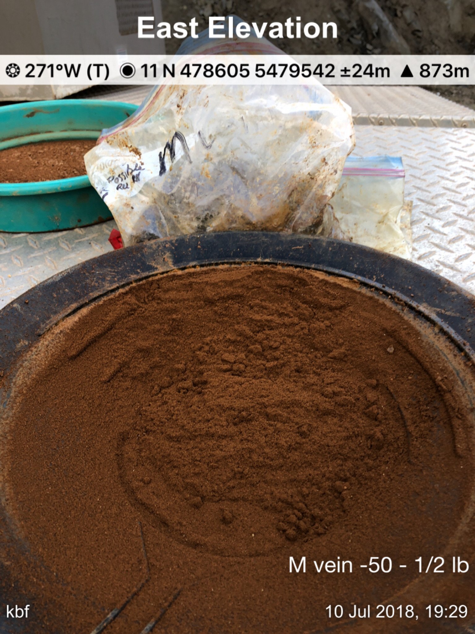
Below that are three 40X magnification pictures of May & Jennie gold panned from concentrate
OPEN PICTURES FOR FULL-SIZE VIEWS


MAY & JENNIE OBSERVATIONS & CONCLUSIONS
Stricker's conclusions plus the results from a 2018 exploration program and the details from a 1934 Property File 17313 ("Veins" - see below), all combine to form very compelling patterns of data and information that may prove to be GAME CHANGERS for the May & Jennie / Red Top Property.
Additional Thoughts…
In Report 14417, page 22, J.D. Blanchflower states: "All past exploration has concentrated on main May & Jennie vein. This vein is only exposed in the No. 2 adit. It strikes 150 to 160 degrees and dips -80 degrees eastward. Vein widths vary from 10-15 cm to 0.66m with a quartz and pyrite-rich envelope extending beyond into the foot wall section. In the accessible portions of the No. 2 adit, the vein structure has an exposed strike length of 58m, of which more than 35m has a vein width exceeding 0.3 meters. Two cross-cuts off the southeastern drift have intersected a similar sub-parallel vein structure with an indicated length of 30 meters and widths from 15 to 30 cm."
The Ministry Report refers to the May & Jennie vein as "varying "from 5 to 24 feet" and does not note any change from one level to the next. Ref: 1904 Ministry Annual Report page H144 (Ministry Report Annual Report 1903)
In the 1934 Report 17313, the writer states: "The walls of this vein (referring to the May & Jennie) are difficult to locate, owing to the fact that the schist is of variable thickness and in many cases merges into the country rock by almost imperceptible graduations". "For the same reason, the width of the vein is hard to determine, but varies from 20 - 100 feet in round numbers at observed points". "Much greater width of mineralization, however, probably occurs in the unexplored ground". "This vein is almost vertical but for convenient the west wall is called the foot and the east the hanging wall as the vein at certain points dips slightly into the mountain".
That said, at least 4 things rebut Blanchflower's information.
1.) There is no way (other than drilling) to determine vein width(s) along a 58m section of drift unless there was a crosscut at the end of a chip-sample section. To be clear, taking chip samples from along a wall of a drift along a vein does not determine vein width. That said, the term "vein widths" was most likely an error and should have been written as sample widths.
2.) Based on the description of the vein from the 1934 Report, it sounds like the same vein was seen in crosscuts and whoever was doing Blanchflower's sampling was most likely unfamiliar with the May & Jennie structure and therefore did not or was not able to interpret vein width correctly.
3.) I also highly doubt the Minister involved in the inspection of the May & Jennie mine workings was wrong, lying or misinformed about the thickness of the vein in his 1903 Annual Report and if there were dramatic changes in vein width from one level to the next, I would expect it would have been noted. The Minister’s Report does go on to say (referring to Level 2) that "there has been considerable crosscutting done, disclosing large bodies of ore". Mines were always visited personally by the Minister himself or one of his Representatives so that information could be verified.
4.) I have seen how the vein fades in and out very discreetly with layers of schist, then more vein, then more schist. Just when you think the vein has ended, it begins to appear again.
To add to this confusion, on Page 10 (page 13 of the file) of the Stricker report, Stricker most likely copied and pasted Blanchflower's typo and then confused matters worse by following that up with another quote about the two mine levels and their associated raises and then ended the quote with (B.C.M.M.A.R. 1904, p. H144) which leads a reader to believe the width of the vein (according to the Ministry Report) ranges from 15cm. to 0.66m in the No.2 level workings when this is very clearly NOT the case.
In conclusion and not wanting to repeat myself (I will anyway), what I believe to be a simple wording error, "vein width" vs. "sample width" in a 1984 report has led readers to believe the May & Jennie vein narrows in width from an average of 4.25m (ranging from 1.52m - 7.32m) at Level 1, down to 15cm - 0.66m at Level 2 for the past 37 years and is likely much of the reason this wonderful 250,000 - 500,000 +ounce GOLD PROSPECT has never been developed to this day.
The May & Jennie / Red Top Gold Mine very clearly is one of the remaining (under-developed) GEMS in the Nelson Mining Camp.
THE MAY & JENNIE PROPERTY IS AVAILABLE FOR SALE OR OPTION